If you're nearby
Scored from our data, not ads.
Weekdays · quietest around 8p
Weekends · quietest around 8p
Estimate from the type of place and how famous it is. Holidays run busier.
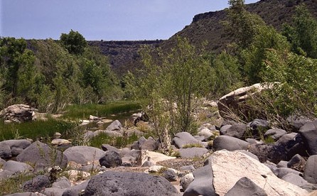
Agua Fria National Monument is in the U.S. state of Arizona, approximately 40 miles (64 km) north of downtown Phoenix, Arizona. Created by Presidential proclamation on January 11, 2000, the 72,344-acre (113 sq mi; 293 km2) monument is managed by the Bureau of Land Management, an agency within the U.S. Department of the Interior. The Bureau of Land Management already managed the lands; however, under monument status the level of protection and preservation of resources within the new monument have been enhanced.
The monument is a unit of the BLM's National Landscape Conservation System. Over 450 distinct Native American structures have been recorded in the monument, some of large pueblos containing more than 100 rooms each. The enhanced protection status also provides greater habitat protection for the numerous plant and animal communities.
Antiquities
Petroglyphs are scattered across the numerous puebloan ruins, which were built between 1250 and 1450 C.E. when several thousand Native Americans, known as the Perry Mesa Tradition, inhabited the region. The petroglyphs depict animals, geometric figures and abstract symbols and are found by the thousands. Numerous ruins of agricultural...
Text from Wikipedia: Agua Fria National Monument and Wikivoyage: Agua Fria National Monument, CC BY-SA 4.0.
Guided tours, tickets and experiences from our partners.
Been to Agua Fria National Monument? Rate it and share the best time, where to park, what to skip.
